


In an era where smartphones, GPS, and navigation apps are ubiquitous, it’s easy to forget the ancient art of navigating the outdoors without technology. However, the truth is that even in the most remote and rugged terrains, a skilled traveler can navigate a trail without relying on a GPS. In fact, some of the best outdoor adventurers do so every day. Whether you’re a hiker, backpacker, or wilderness explorer, understanding how to navigate using traditional methods can enhance your connection to nature, improve your survival skills, and provide a much-needed backup if your devices fail.
This guide will explore the essential skills needed to navigate trails without GPS. From map reading and using a compass to understanding natural signs and landmarks, we’ll cover the fundamentals of navigation that will help you feel confident in the wild.
1. Why Navigate Without GPS?
Before diving into techniques, it’s essential to understand why navigating without GPS is a valuable skill. Here are some key reasons:
- Reliability: GPS devices and smartphones can lose signal, especially in dense forests, deep valleys, or areas with no cellular coverage. By relying on traditional navigation methods, you’re not dependent on technology that might fail.
- Self-sufficiency: Mastering navigation without GPS fosters independence and gives you confidence that you can find your way in the wilderness. It reduces anxiety during remote hikes or emergencies.
- Increased Awareness: When you’re focused on natural markers and physical maps, you’re more in tune with your surroundings. This allows you to truly experience the landscape rather than simply following a digital path.
2. Key Navigation Tools
To navigate a trail effectively without GPS, you need the right tools. While these may seem simple, they are invaluable when it comes to finding your way.
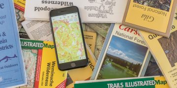
A. Topographic Map
A topographic map is the foundational tool for traditional navigation. These maps show detailed elevations, terrain features (like mountains, rivers, and valleys), and key landmarks. Unlike regular road maps, topographic maps use contour lines to depict the shape of the land. Understanding how to read these maps is crucial to your success.
How to Read a Topographic Map:

- Contour Lines: Contour lines represent elevation and terrain shape. Closely spaced lines indicate steep terrain, while widely spaced lines suggest flat ground.
- Symbols: Look for the various symbols used to represent features like trails, water bodies, and landmarks. Common symbols include blue for water, brown for elevation, and green for vegetation.
- Scale: Check the map scale to understand the distance between two points. For example, a 1:50,000 scale means that 1 cm on the map represents 500 meters in the real world.
B. Compass
A compass is a key tool in traditional navigation. It helps you determine direction and orient yourself on the map.
How to Use a Compass:
- Orient the Map: Lay your map flat and align it with the compass. Ensure that the compass’s needle is pointing north, and rotate the map until the map’s north aligns with the compass’s north.
- Taking a Bearing: To navigate to a specific point, first identify the direction you need to travel on the map. Use the compass to take a bearing by placing the compass along the route and aligning it with the map’s grid lines.
- Following the Bearing: Keep the compass needle pointing north as you walk, adjusting your direction when necessary to stay on course.
C. Altimeter
An altimeter measures your elevation above sea level, helping you track your altitude during your hike. This tool is especially useful when traversing mountainous terrain where elevation changes can be dramatic. By comparing the altitude you read with the map’s elevation markers, you can confirm your location and help guide your route.
3. Basic Navigation Skills
With the right tools, you’re ready to begin navigating without a GPS. Here are several basic skills every outdoor adventurer should master:
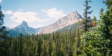
A. Understanding the Landscape
The key to traditional navigation is reading the natural landscape. Natural features can act as vital navigational aids when used correctly.
- Rivers and Streams: Water features often run in predictable directions, so following a river or stream can help you get your bearings. In many cases, rivers flow towards valleys or larger bodies of water, which can be used as reference points.
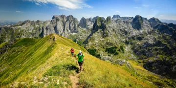
- Ridges and Peaks: High ground, such as ridges or peaks, offers good vantage points to orient yourself and get a clear view of your surroundings. If you can see the terrain below, you can identify landmarks and routes.
- Vegetation: Different types of vegetation can indicate specific elevations or types of terrain. For example, forest cover is common in lower altitudes, while alpine meadows appear at higher elevations.
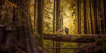
B. Using Landmarks
Landmarks are natural or man-made features that help you orient yourself on the map. These can be mountains, rivers, distinctive trees, or even man-made structures like towers or bridges. The trick is to identify these landmarks on your map and use them as reference points.
For instance, when hiking through a forest, a large, unique rock formation could serve as a landmark. By using your compass and map to determine its location, you can plan your next steps with greater accuracy.
C. Re-Orienting Your Map
At times, you may find yourself off-track or disoriented. To reorient yourself, stand still and check the terrain for landmarks that match what you see on your map. Then, use your compass to get your bearings and adjust your route.
4. Advanced Techniques for Trail Navigation
Once you’ve mastered the basics, there are more advanced techniques you can use to navigate trails effectively, even without technology.

A. Dead Reckoning
Dead reckoning involves navigating based on known direction, distance, and time. It’s a particularly useful technique when the terrain lacks obvious landmarks.
To use dead reckoning, you’ll need to know your starting point and have a rough idea of your bearing and distance. For instance, if you walk for an hour in a particular direction, you can estimate how far you’ve traveled, based on your pace and the terrain. A compass helps keep you on track by ensuring you maintain the correct bearing.
B. Using the Sun and Stars
Sun and star navigation is a time-honored technique that uses the position of celestial bodies to determine direction.
- The Sun: In the northern hemisphere, the sun rises in the east and sets in the west. At noon, the sun will be in the southern sky. Using this knowledge, you can estimate your direction during daylight hours.
- Stars: At night, the stars can guide you. The North Star (Polaris) always points north in the northern hemisphere, making it an excellent reference for orienting yourself. In the southern hemisphere, the Southern Cross constellation serves a similar purpose.
C. Terrain Association
Terrain association involves using features of the landscape to identify where you are on the map. For example, if you pass a distinctively shaped hill or valley, you can cross-reference it with your map to confirm your position. This method can be particularly useful in areas where trails are poorly marked or when visibility is limited.
5. Tips for Navigating Safely Without GPS
- Always Carry a Backup: Even if you prefer traditional navigation, it’s a good idea to carry a GPS device or smartphone as a backup. In case you get lost, you’ll have a backup system.
- Plan Ahead: Before heading out, study the map and familiarize yourself with the terrain. Know the key landmarks, trails, and potential hazards.
- Stay Calm if Lost: If you get lost, the most important thing is to stay calm. Use your tools—compass, map, and natural landmarks—to orient yourself. Remember, you can always retrace your steps if necessary.
- Practice Regularly: Like any skill, navigation improves with practice. Try taking short, simple hikes and practice using your map and compass. Over time, you’ll become more proficient.
6. Conclusion
Navigating a trail without a GPS is not only a skill that can keep you safe, but it can also deepen your connection to the natural world. By mastering the tools of traditional navigation—maps, compasses, and natural cues—you’ll gain a greater understanding of your environment and become more self-sufficient.
Even though GPS technology is a useful tool, there’s something special about relying on your own abilities to navigate the wilderness. So, next time you head out on a trail, consider leaving the GPS behind (or at least as a backup) and challenge yourself to explore the outdoors the old-fashioned way.
Embrace the adventure and the journey—after all, the best part of navigation isn’t always about the destination.


